
Gujarat · Offbeat Spotlight
Dholavira, Gujarat: The Complete Guide to the Harappan City in the Rann

By Beauty of Bharat — India travel guide, every place, every flavour.
Guides covering all 36 States and UTs, researched from official sources and checked at publish time. Corrections welcome — see About Beauty of Bharat.
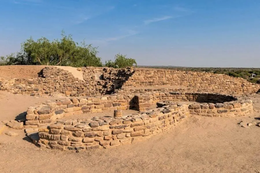
Five thousand years ago, a city rose in a desert with no river — and solved that problem so well that its reservoirs are still studied by water engineers. Above its grandest gate hung a signboard ten symbols long. Nobody has read it yet. Dholavira, Gujarat is the excavated Harappan city on Khadir Bet island in the Great Rann of Kutch, occupied roughly 3000–1500 BCE and inscribed as a UNESCO World Heritage Site on 27 July 2021. Its sixteen or more stone reservoirs kept it alive on about 260–300 mm of rain a year.
Dholavira is a full day in the Rann — which is why it belongs in our offbeat spotlight series, alongside Ziro Valley, Majuli, Gandikota and Thenzawl. For the wider state picture, see our Gujarat guide and the best places to visit in India.
Dholavira, Gujarat at a glance
| Where | Khadir Bet island, Great Rann of Kutch, Kutch district, Gujarat |
| Age | Occupied roughly 3000–1500 BCE; one of the five largest Harappan cities |
| UNESCO | Inscribed 27 July 2021 as "Dholavira: A Harappan City", criteria (iii) and (iv) |
| What makes it different | Three walled parts; the earliest known stone water system |
| Best time to visit | October to March |
| Getting there | Bhuj, roughly 215–250 km by road |
| Don't miss | Reservoirs, signboard, Fossil Park, Road to Heaven |
A city built without a river
Most great Harappan cities stood on great rivers. Dholavira did not. It stands on Khadir Bet, an island of higher ground in the Great Rann of Kutch, between two seasonal streams — the Mansar to the north and the Manhar to the south. The city covers about 100 hectares.
Archaeologist J. P. Joshi of the Archaeological Survey of India (ASI) first identified the site in 1967–68; the ASI excavated it under R. S. Bisht from 1990, across thirteen field seasons until 2005, defining seven stages of occupation — about 1,500 years of continuous life. UNESCO calls Dholavira an exceptional Bronze Age urban settlement; it became India's 40th World Heritage Site, and the first Indus Valley Civilisation site in India to receive the tag.
The water system that made Dholavira possible
Dholavira survived because its planners designed the whole city around water. Archaeologists have identified sixteen or more reservoirs, cut into rock and lined with dressed stone, around the city's walls. The largest measures roughly 73–79 metres long and about 7 metres deep; together they could hold on the order of 250,000 cubic metres. A fifth to a third of the fortified city was water storage.
Rainfall and runoff from the Mansar and Manhar were slowed by check dams, then channelled through stone drains and stepped cascades into the reservoirs, with a small stepwell at the bottom of the largest. It is, by the excavators' account, the earliest known urban-scale water-harvesting system built entirely of stone. That logic — catch every drop, store it in stone — is still quoted by water researchers as a working model.
What to see at Dholavira
The citadel
The highest and most strongly fortified part of the city, on raised ground at the south, divided into two enclosures usually described as the castle and the bailey. This was the seat of authority, ringed by massive walls, gates and towers. Climb up for the view across the planned city below.
The signboard
Dholavira's most famous find stood above the northern gateway of the citadel, facing the ceremonial ground: a board about three metres long carrying ten large signs of the Indus script, each roughly 37 centimetres tall, formed from pieces of white gypsum inlaid into wood. The wood has perished, but the signs collapsed in order, preserving their arrangement. It is often called the world's earliest known signboard. What it says, nobody knows: the Indus script remains undeciphered.
Middle town and lower town
Below the citadel, the middle town — separately walled, its streets on a planned grid — housed officials and people of standing, while the lower town held the artisans and traders, including bead-making workshops, and a cemetery of varied burial forms beyond the walls. The hierarchy was built into the plan.
The stadium and ceremonial ground
Between the citadel and the middle town lies a large open ground, enclosed on four sides by stepped grandstands. The larger of the site's two such grounds measures about 305 metres by 49 metres. It is usually described as a stadium, and it may have hosted ceremonies, markets or festivals — though what exactly took place there is not settled.
The Fossil Park, 10 km north
About 10 kilometres north of the site, on a low hill above the Rann, lies the Wood Fossil Park — fossilised tree trunks scattered across the slope, often described as Jurassic-era remains around 200 million years old. It is not a developed park: no ticket, no display, just the fossils, the wind and a wide view over the salt flats. The last stretch of road can be rough; visitors commonly walk the final few hundred metres. Go at sunrise or late afternoon.
The Road to Heaven
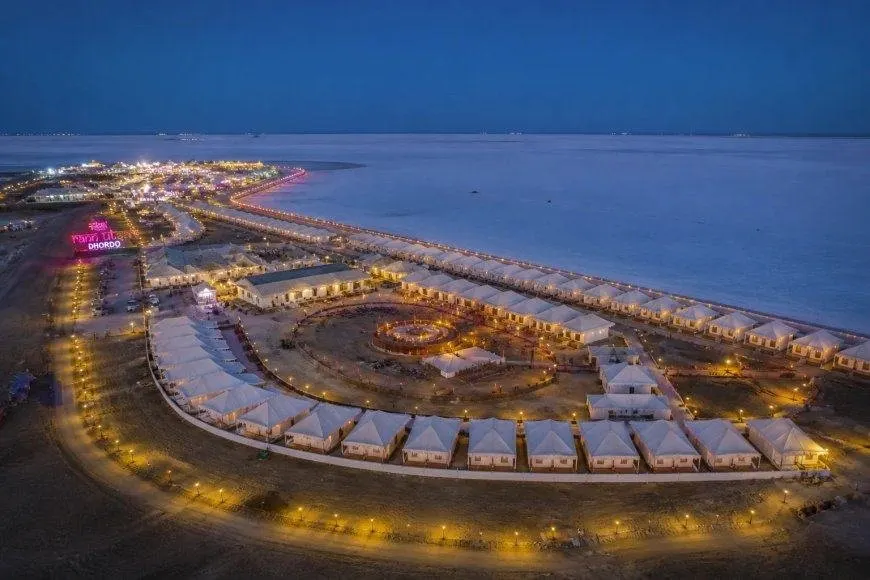
The journey is half the experience. The newer route runs north from Bhuj to Khavda, then across the Great Rann on a dead-straight causeway of about 30 kilometres — part of NH 754K — to Khadir Bet. It is known as the Road to Heaven: white salt on both sides, shallow water after the rains, and a horizon so flat the road seems to vanish into the sky. Drive it at sunrise or sunset, when the salt turns pink and gold; in winter the shallow water draws migratory birds, flamingos among them.
How to Reach Dholavira from Bhuj
Bhuj is the gateway, with two genuinely different routes. The classic all-year route runs via Bhachau and Rapar, about 250 km and 5–6 hours; Rapar is the last major town, about 90 km from Dholavira. The scenic route runs via Khavda and the Road to Heaven, about 215–235 km and 4.5–5.5 hours. Ahmedabad is roughly 330–400 km away; Dhordo, in the Rann Utsav season, about 160 km.
By air: Bhuj airport is the nearest, with flights from Mumbai and Ahmedabad. By rail: Bhuj is the nearest major railhead; Samakhiali, about 140 km away, is closer. By bus: a daily state bus is reported to leave Bhuj in the early afternoon — confirm the timing at the station. By car: a hired car with a driver from Bhuj is what most visitors do. Fuel up and carry cash before Rapar. No permit is needed to visit Dholavira itself.
Best Time to Visit Dholavira
October to March is the best time to visit Dholavira, and November to January is the peak: warm days, cool nights and the white Rann at its best. This is also the Rann Utsav season at Dhordo; see our Rann of Kutch and Rann Utsav guide. From April to June it is very hot, often over 40°C, and from July to September the monsoon can leave roads muddy.
Dholavira Entry Fee and Timings
Published figures disagree, so treat any single number with care. Recent visitors report free entry to the site, while other guides list ₹40 for Indian visitors (₹600 for foreign visitors), with the museum at ₹20/₹300. Timings are reported as roughly 9 am to 5 or 6 pm, with the museum reported closed on Fridays. Confirm the current fee and timings at the gate or on the ASI website before you go — the figures change.
A one-day Dholavira plan — and where to stay
Morning: leave Bhuj before dawn by the Khavda route, crossing the Road to Heaven as the sun comes up. Late morning: three to four hours at the site — carry water, as there is almost no shade, and do not climb the walls — citadel first, then the reservoirs, the signboard, the middle and lower towns, and the museum. Afternoon: lunch in Dholavira village, then the Fossil Park in the low light. Evening: drive back to Bhuj, or stay the night — the better call, with small resorts and homestays in the village and a superb night sky over the Rann.
Watch Dholavira on film
Videos are by their respective creators.
Dholavira FAQs
How far is Dholavira from Bhuj?
About 215–250 km: roughly 250 km via Bhachau and Rapar (5–6 hours), or 215–235 km via Khavda and the Road to Heaven (4.5–5.5 hours).
What is the best time to visit Dholavira?
October to March, with November to January the peak. Avoid April to June (very hot, often over 40°C) and July to September (monsoon mud).
What is the entry fee for Dholavira?
Sources disagree: recent visitors report free entry, while other guides list ₹40 for Indian visitors (₹600 for foreign visitors). Timings are reported as roughly 9 am to 5 or 6 pm, with the museum reported closed on Fridays. Confirm at the gate before you go.
Why is Dholavira a UNESCO World Heritage Site?
UNESCO inscribed Dholavira on 27 July 2021, under criteria (iii) and (iv), for its three-part plan, fortifications and stone water system. It was India's 40th World Heritage Site and the first Indus Valley Civilisation site in India to receive the tag.
Do you need a permit to visit Dholavira?
No. You simply drive in — by the Rapar road or across the Road to Heaven causeway — and walk the site in daylight hours.
Dholavira answers a question most travellers never think to ask: what does a city look like when it has everything except water? The answer is still standing in the Rann, in stone. Come for the archaeology and the road across the salt — and if the desert has you planning more, read our Rann of Kutch guide, our Gujarat guide, or start wider with India state by state.
Plan your Gujarat trip
Dholavira's Harappan ruins, the white Rann, and the Road to Heaven.
Gujarat state guide →