
Offbeat Place · Northeast India
Nongstoin: Waterfalls, Nongkhnum Island and the Quiet West Khasi Hills

By Beauty of Bharat — India travel guide, every place, every flavour.
Guides covering all 36 States and UTs, researched from official sources and checked at publish time. Corrections welcome — see About Beauty of Bharat.
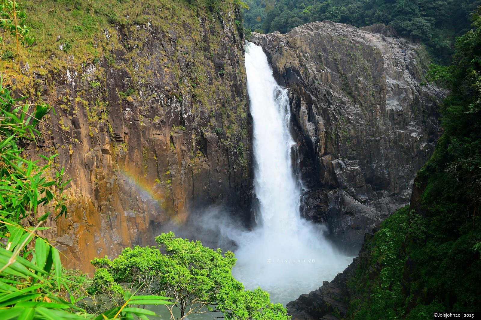
Nongstoin is the town most travellers pass through on their way to somewhere else — and that is exactly why it is worth stopping in. The headquarters of Meghalaya’s West Khasi Hills sits on a rolling plateau where the Kynshi River has carved out Nongkhnum, the state’s largest river island, and where waterfalls drop hundreds of metres into green valleys that most of Meghalaya’s visitors never see.
Come here and the pace changes: mornings in a working Khasi market town, days out to Langshiang Falls and the beaches of Nongkhnum Island, evenings watching the light go over Mawphanlur’s lakes. Nongstoin is not a resort town — it is a base, and the best way to use it is as one: arrive in daylight, settle in, and give the falls and the island the early hours of the next day.
Nongstoin at a Glance
| State | Meghalaya |
| Region | Northeast India |
| Known for | Nongstoin is known as the West Khasi Hills district town and the base for Nongkhnum Island, Langshiang Falls and the waterfalls of the Kynshi valley |
| Gateway | Nongstoin & Shillong, Meghalaya |
| Best time to visit | October to April brings settled weather for the falls and the island; December to February is pleasantly cold. |
| Time needed | two days with Nongkhnum Island and the falls |
| State capital | Shillong |
| More offbeat in Meghalaya | 4 more places in this guide |
Why Nongstoin Stays Off the Beaten Path
Nongstoin is the administrative heart of the West Khasi Hills and the largest town in the district, yet it barely registers on Meghalaya’s tourist map. Most visitors drive the Shillong–Cherrapunji–Mawlynnong triangle and never turn west — so the waterfalls, river island and viewpoints around Nongstoin stay quiet, shared with school groups, anglers and local families rather than tour crowds.
Presented honestly as lesser-known, never as an “undiscovered secret”: Nongstoin is known and loved locally, and facilities are plainer than in Shillong. Go for the place itself — the slower mornings, the market, the sense of Meghalaya without a crowd in front of it — and it will not disappoint.
Things to Do in Nongstoin
The highlights below are the reasons to make the detour. None of them need a packed schedule — Nongstoin rewards travellers who pick two or three and linger over them.
Nongkhnum Island
About 14 km from Nongstoin, the Kynshi River’s island is the largest river island in Meghalaya — and the second-largest in Asia after Majuli — a plateau of sandy beaches, open meadows and waterfalls, with Weinia Falls on its northern side, Kshaid Thum Falls on its southern side and Langshiang Falls on its western side. Cross the bridge from Nongstoin and give it a full day or an overnight stay.
Langshiang Falls
About 24 km from Nongstoin, Langshiang Falls drops about 337 metres into the Kynshi valley — one of India’s highest waterfalls — and looks its best just after the monsoon, when the river is full and the surrounding forest is at its greenest. A rainbow often hangs in the spray on bright mornings.
Weinia Falls
On the northern side of Nongkhnum Island, Weinia Falls pours down the Kynshi with a bridge and viewing platform that make it the easiest of the area’s falls to see properly. Come in the morning, when the light is on the water and the island is still quiet.

Kyllang Rock
Near Mairang, about 35 km from Nongstoin, Kyllang Rock is a single huge solid granite rock rising out of the hills — one of the area’s most distinctive landmarks. Climb it for the view over the West Khasi Hills, and pair it with Mawthadraishan Peak for a full day out.
Mawthadraishan Peak
On the northern side of the Nongstoin–Shillong road, near Nongshillong, Mawroh and Markasa villages, Mawthadraishan is one of the highest peaks in the Khasi Hills. The walk from the main road takes about an hour and a half, and the top gives a panoramic view over the plains of Assam — and, after the monsoon, the distant Himalayas.
Mawphanlur
About 15 km from Nongstoin, Mawphanlur is a quiet cluster of lakes in green hills — a picnic and camping landscape that feels a world away from the town. It is at its best in the early morning, when the water is still and the hills are wrapped in mist.

Best Time to Visit Nongstoin
October to April suits Nongstoin best, when the weather is settled and the falls and the island are at their most accessible; December to February is pleasantly cold. The monsoon (May–August) makes the waterfalls spectacular but very wet, and heavy rain can make the river high and the tracks slippery. The Shad Suk Mynsiem thanksgiving dance, the town’s biggest festival, is the best time to see Khasi culture at its most vivid — check the year’s dates before you plan around it.
Across Meghalaya the wider season runs like this: October–April for many outdoor plans; monsoon is spectacular for waterfalls but very wet and can affect trekking. Time Nongstoin inside that window and you get the place at its best — and, this being the offbeat list, usually without the peak-season pressure of the headline stops.
How to Reach Nongstoin
Nongstoin is reached by road from Shillong, about 95 km away on NH 44E — roughly two and a half to three hours — and from Guwahati, about 165 km away via Rani, roughly three to four hours. Most visitors hire a vehicle from Shillong or Guwahati, then explore the falls and the island from Nongstoin as a base.
Most travellers fold Nongstoin into a wider Meghalaya trip rather than coming only for it — paired with Shillong or the state guide’s headline stops, it becomes the quiet chapter of the journey.
Nongstoin — Transport at a Glance
| Nearest airport | Guwahati (GAU) is the main gateway; Shillong Airport at Umroi (SHL) has limited flights |
| Nearest railway station | Guwahati is the railhead; the West Khasi Hills are all road from Shillong |
| By road | By road from Shillong via NH 44E (about 95 km) and from Guwahati via Rani (about 165 km); most visitors hire a vehicle and go for two days |
| Getting around | The falls and the island are reached by hired vehicle from Nongstoin town; Nongkhnum’s beaches and falls are walked |
More Offbeat Places in Meghalaya
Nongstoin is one of 5 offbeat corners in the Meghalaya state guide — pair it with a sibling below for a slower, deeper trip.
Mawphlang Sacred Forest

Known for: indigenous ecological traditions. Nothing about Mawphlang Sacred Forest is staged for visitors. Come outside the short peak window and you may share its best hours with almost no one — that, more than any single sight, is the luxury here.
Laitlum Canyon

Known for: dramatic valley views. Nothing about Laitlum Canyon is staged for visitors. Come outside the short peak window and you may share its best hours with almost no one — that, more than any single sight, is the luxury here.
Mawsynram
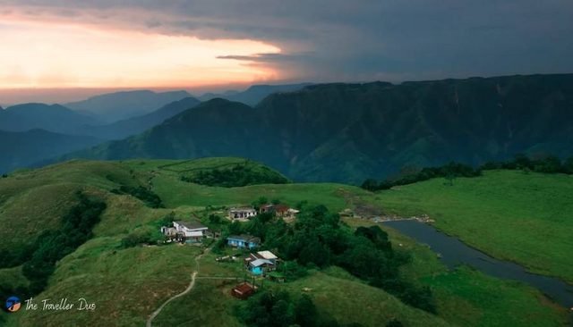
Known for: extreme-rainfall landscape. The headline sights of Meghalaya draw the crowds for good reason, but Mawsynram moves at a different pace: fewer signboards, fewer queues, and more of the state as its own people know it.
Nongkhnum Island

Known for: a large river island of sandy beaches, open meadows and waterfalls. Nothing about Nongkhnum Island is staged for visitors. Come outside the short peak window and you may share its best hours with almost no one — that, more than any single sight, is the luxury here.
While You Are in Meghalaya
Start from the full Meghalaya travel guide for the complete picture. Headline destinations to pair with this trip: Shillong · Cherrapunji/Sohra · Mawlynnong. And eat the state properly while you are there — Jadoh · Dohneiihong lead the table in the Food Atlas.
Frequently Asked Questions
What is Nongstoin known for?
Nongstoin is known as the West Khasi Hills district town and the base for Nongkhnum Island, Langshiang Falls, Weinia Falls, Kyllang Rock and Mawphanlur — the waterfalls and river island of the Kynshi valley. It sits in this atlas on Meghalaya’s offbeat list — the state’s quieter, lesser-visited side.
How far is Nongstoin from Shillong?
About 95 km by road on NH 44E, roughly two and a half to three hours. Most visitors hire a vehicle from Shillong, or take a shared taxi or bus to Nongstoin and hire locally.
How far is Nongstoin from Guwahati?
About 165 km by road via Rani, roughly three to four hours. Guwahati’s airport (GAU) is the main gateway, and Guwahati is the nearest railway station.
What are the tourist places near Nongstoin?
Nongkhnum Island (about 14 km), Langshiang Falls (about 24 km), Weinia Falls (about 15 km), Kyllang Rock (about 35 km), Mawthadraishan Peak and Mawphanlur lakes (about 15 km). Most visitors cover the island and two or three falls in two days from Nongstoin town.
What is the best time to visit Nongstoin?
October to April, when the weather is settled; December to February is pleasantly cold. Waterfalls look strongest just after the monsoon, while peak monsoon itself is very wet and can make the river high. For Meghalaya as a whole, October–April for many outdoor plans.
Do I need a permit to visit Nongstoin?
No. Meghalaya does not need an Inner Line Permit. Carry a government photo ID; foreign nationals should carry their passport and visa.
Every Place. Every Flavour.
Nongstoin is one of 154 offbeat places in this atlas — alongside 36 states and union territories, 188 destinations and 213 regional dishes, each with its own full guide page.
Explore all 36 states Read the blog