
UK Weather · News Corner
Will Britain Freeze in November? What the El Niño Forecasts Actually Say

By Beauty of Bharat — India travel guide, every place, every flavour.
Guides covering all 36 States and UTs, researched from official sources and checked at publish time. Corrections welcome — see About Beauty of Bharat.
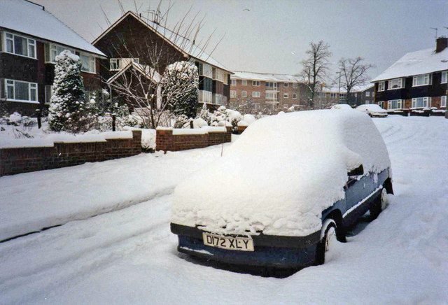
Reports of freezing temperatures reaching Britain as early as November have spread this week, driven by forecasts of a weakening polar vortex and a powerful El Niño — but the UK's own forecaster stresses that a cold snap is a raised risk, not a done deal, and no freeze has been forecast with confidence.
This post reflects reporting available on 30 October 2026, including The Standard (3 October 2026), British Bulletin (29 October 2026), BritBrief (29 October 2026), LondonStreets and Times of India. Where sources disagree or a detail is unconfirmed, the article says so.
What the forecasts say
The immediate trigger for the headlines is forecast data, cited in reports, showing stratospheric winds above the Arctic weakening sharply in the coming days. NASA forecast data quoted in those reports projects wind speeds in the polar vortex falling to 12.04 metres per second by 31 October, then 9.15 metres per second on 1 November, and 4.15 metres per second by 3 November — a much earlier disruption than earlier predictions, which had placed it around January 2027.
Separately, weather-model maps from the GFS model, reported on 29 October, suggest snow could fall across 50 UK counties in mid-November, with up to 16 centimetres possible on high ground in western Scotland and 13 centimetres on high ground in Wales, while accumulations in England are not expected to reach much above one centimetre. The same model output puts the first snow on high ground in western Scotland on the morning of 10 November, reaching Wales in the early hours of 11 November. These are outputs from one forecast model, not an official forecast.
What the Met Office actually says
The Met Office's own position is more cautious. A spokesperson said: 'Through the latter part of the winter, following a peak in El Niño, the stratospheric Polar Vortex can become weaker, leading to an increased chance of Sudden Stratospheric Warming (SSW) events unfurling, increasing the potential for cold weather.' Sudden stratospheric warming is a rapid warming high above the Arctic, between about 10 and 50 kilometres above the Earth's surface, which can weaken or reverse stratospheric winds and, weeks later, bend the jet stream into a blocking pattern that lets cold air spill south.
Dr Will Lang, the Met Office's chief forecaster, described the shift as a 'subtle shift in the odds' rather than a certainty, saying the UK was going in with a heightened potential for wet weather, potentially stormy conditions, and consequently a heightened potential for flooding. Climate spokesman Grahame Madge added that the El Niño event was still developing but had already surpassed the magnitude of previous events including 2015/16, with a tendency towards a stormier start to autumn and winter and colder spells at the end of winter.
The El Niño backdrop
The wider context is an El Niño that forecasters describe as exceptionally strong. The World Meteorological Organization said in its 8 October update that El Niño was firmly established and strengthening rapidly, with sea-surface temperatures forecast to reach record levels in October to December 2026. Its seasonal outlook put the central Pacific anomaly at about 3.7 degrees Celsius above normal, above the previous record of 2.6 degrees set in 2015/16, with a peak expected in December and a near-100 per cent likelihood it persists through February 2027.
A research paper from the US government's NOAA Chemical Sciences Laboratory concluded that El Niño 'tends to promote the breakdown of the polar vortex, especially in late winter'. That is why forecasters are watching the vortex at all — but a tendency is not a timetable, and the Met Office notes that El Niño is only one of several factors shaping UK weather.
What is still unconfirmed
Most importantly, no sudden stratospheric warming has actually been confirmed yet, and one analysis noted that NASA's forecast still had stratospheric winds blowing in their normal westerly direction through 5 November. A figure of 86 per cent quoted in some coverage is not a calibrated probability at all: it comes from one European model run on 27 October in which 43 of 50 ensemble members forecast a wind reversal by 10 November, while other forecasting systems are considerably more cautious.
Meteorologists also caution that individual warming events can only be forecast with confidence roughly a week beforehand, and that even when one occurs, its effects on surface weather typically take several weeks to appear — and a fair share of warmings never produce a cold response at the surface. The last time a disrupted vortex delivered a genuine London freeze was the Beast from the East in late February 2018. For now, the honest reading is watchfulness, not alarm.
Context and what to watch
The single most important sentence in this story is a negative: no official forecast guarantees a November freeze. What forecast models show is a possible weakening of the polar vortex, and the Met Office says that raises the chance of cold snaps — it does not confirm one. The mechanism behind that language is sudden stratospheric warming, a rapid warming high above the Arctic, between about 10 and 50 kilometres up, which can weaken or reverse the winds of the polar vortex and, weeks later, shift the jet stream so that cold air can reach the UK. The chain is long, the timing is loose, and each link adds uncertainty — which is why a possible vortex weakening in the models is a long way from a forecast freeze at ground level.
El Niño adds a second layer of maybe. It tends to bring a stormier start to autumn and winter in the UK, and later in winter it can raise the chance of the polar vortex weakening, increasing the potential for cold spells — but it is only one factor among several, and the article is careful to say what is still unconfirmed. What to watch is the Met Office's own updates as November approaches, whether the vortex actually weakens as modelled, and whether any cold signal firms up from a raised chance into a dated forecast.
Frequently Asked Questions
Is a UK freeze actually forecast for November?
No. No official forecast guarantees a November freeze. Forecast models show a possible weakening of the polar vortex, and the Met Office says that raises the chance of cold snaps — it does not confirm one.
What is sudden stratospheric warming?
It is a rapid warming high above the Arctic, between about 10 and 50 kilometres up, which can weaken or reverse the winds of the polar vortex and, weeks later, shift the jet stream so that cold air can reach the UK.
How does El Niño affect UK weather?
El Niño tends to bring a stormier start to autumn and winter in the UK, and later in winter it can raise the chance of the polar vortex weakening, which increases the potential for cold spells — but it is only one factor among several.
For more world news, see our News Corner.
More world news
Follow the day's developing stories and the rest of today's world news from the News Corner hub.
More from News Corner →